Kamlial Fm
Type Locality and Naming
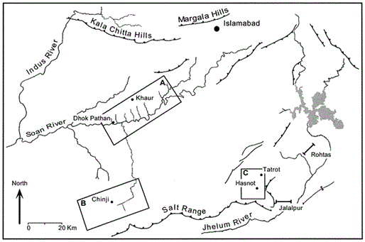
Rawalpindi Gr. – upper formation. Holotype section: Southwest of Kamlial, Attock District. Author: E.S. Pinfold, 1918. Reference section: None.
Lithology and Thickness
Sandstone. The formation consists of purple grey and dark brick red sandstone, which is medium- to coarse-grained and contains interbeds of hard purple shale and yellow and purple intraformational conglomerate. It is distinguished from the underlying Murree Fm by its usually spheroidal weathering and heavy mineral content in which tourmaline dominates epidote. In Murree Fm epidote dominates tourmaline.
Thickness: 50-580 m (68-718 m in subsurface). At the type locality, it is 90 m thick. It is 580 m at Shakardarra SE of Kohat and 120-300 m in western Kohat. 50 m in Surghar Range, 150 m at Pamel Domeli and 180 m at Jhatla in ESR. In the subsurface of Potwar, from east to west, it is152 m in Adhi-5, 68 m at Dhermund-1 and 112 m at Dakhni-1. In Chanda-1 well, west of Indus River, it is 718 m thick.
Relationships and Distribution
Lower contact
Conformably underlain by Murree Fm (broadly transitional). At place overlies Sakesar Fm unconformably. At Kundal (NE end of Khisor Range), Kamlial Fm probably overlies Triassic.
Upper contact
Conformably overlain by Chinji Fm
GeoJSON
Fossils
A number of fossil mammals have been recorded from the formation. Some of the important, as recorded include Trilophodon cf. angustidens, Dinotherium indicum, Amphicyon cf. shahbazi, Hyaenaelurus lahirii, Anthracotherium sp. Hemimeryx blanfordi, Listriodon cf. guptai, L. pentapotomiae, Conohyus cf. sindiensis and others.
Age
Depositional setting
Additional Information


 showing Kamlial, Chinji and Nagri formations.jpg)

